How can we help ?
Digital Acquisition Services
Digital Acquisition Services
Digital Acquisition Services
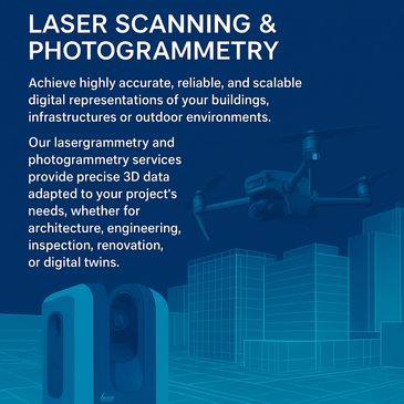
We combine aerial imaging, terrestrial laser scanning, and GNSS positioning to deliver datasets with precision levels ranging from 5 cm to under 1 cm, depending on the chosen workflow and site characteristics.

Project Management
Digital Acquisition Services
Digital Acquisition Services
Turning data chaos into process and insights... one project at a time! Validating business goals and laying the foundation for projects, we anchor them in clarity and purpose. Adhering to PMI guidelines, we plan with the agreed and adapted methodology to mitigate risk and ensure success. We recognize that monitoring progress, making adjustments to ensure stakeholder satisfaction and optimal outcomes are key. This helps us close the projects with a smile and learn for future endeavors.

Data Governance
Digital Acquisition Services
Data Engineering
Get introduced to Data Clan's DMMA, a self service data management assessment tool designed to support organizations' sustainable data capabilities and align them with their corporate objectives.
Get in touch for a demo and a call on how DMMA can help your organization and your projects.

Data Engineering
Dronesoccer Teambuilding
Data Engineering
Building data bridges and connecting data lakes, creating trusted data to keep your data operations and organization flowing. With our extensive experience in global data warehousing and data loading operations, we design scalable and resilient high-level data architectures. These can then be updated using pipelines that implement ELT or ETL from data lakes. We collaborate and validate our deliverables with data scientists, analysts, and other stakeholders to ensure that data is timely, accurate, and accessible.
Dronesoccer Teambuilding
Dronesoccer Teambuilding
Dronesoccer Teambuilding
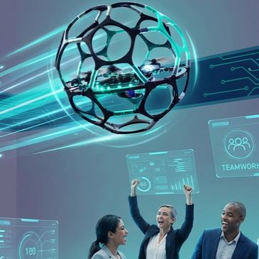
Bring your team together around innovation, creativity, and hands-on exploration with our Drone Soccer Teambuilding Program.
Designed for tech-oriented companies, this unique experience blends engineering, problem-solving, and team spirit in a fun, engaging, and future-facing activity.
Whether your goal is to strengthen collaboration, spark curiosity, or simply offer your team an unforgettable moment